Professional Surveying Services
Comprehensive land surveying solutions tailored to your specific needs, delivered with precision and professionalism
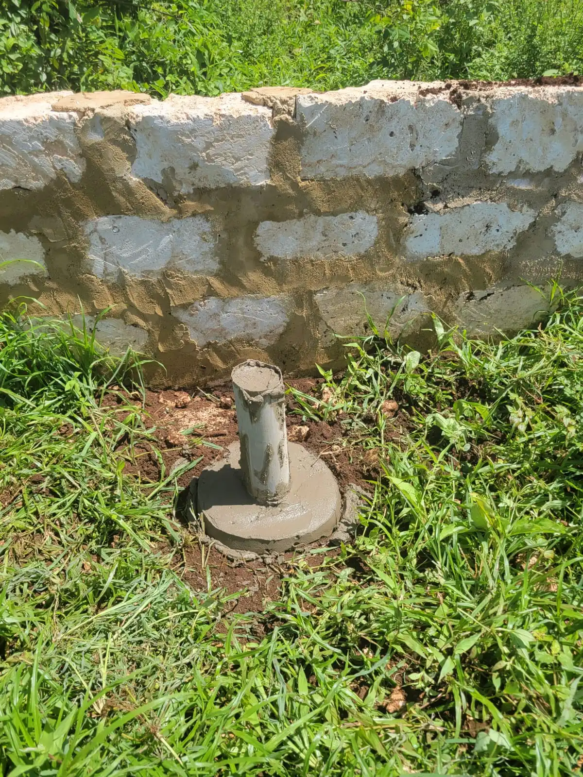
Boundary & Land Surveys
Define your property boundaries with precision and legal certainty. Our boundary surveys establish exact property lines, identify encroachments, and provide legally recognized documentation.
Who Needs This Service?
- ✓ Property buyers and sellers
- ✓ Real estate developers
- ✓ Land dispute resolution
- ✓ Property owners establishing boundaries
- ✓ Financial institutions for mortgages
Deliverables
- ✓ Professional survey report
- ✓ Beacon placement and planting
- ✓ Boundary diagram/map
- ✓ Beacon certificate
- ✓ Land Survey Board compliant documentation
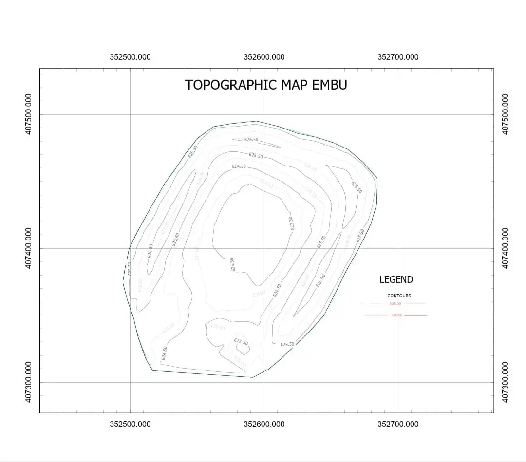
Topographic Mapping
Detailed terrain mapping showing elevation contours, natural features, and man-made structures. Essential for construction planning, environmental assessments, and land development.
Who Needs This Service?
- ✓ Architects and engineers
- ✓ Construction companies
- ✓ Environmental consultants
- ✓ Real estate developers
- ✓ Mining and quarry operators
Deliverables
- ✓ Contour map (1m intervals)
- ✓ Digital Elevation Model (DEM)
- ✓ 3D terrain visualization
- ✓ Cross-section drawings
- ✓ Volume calculations
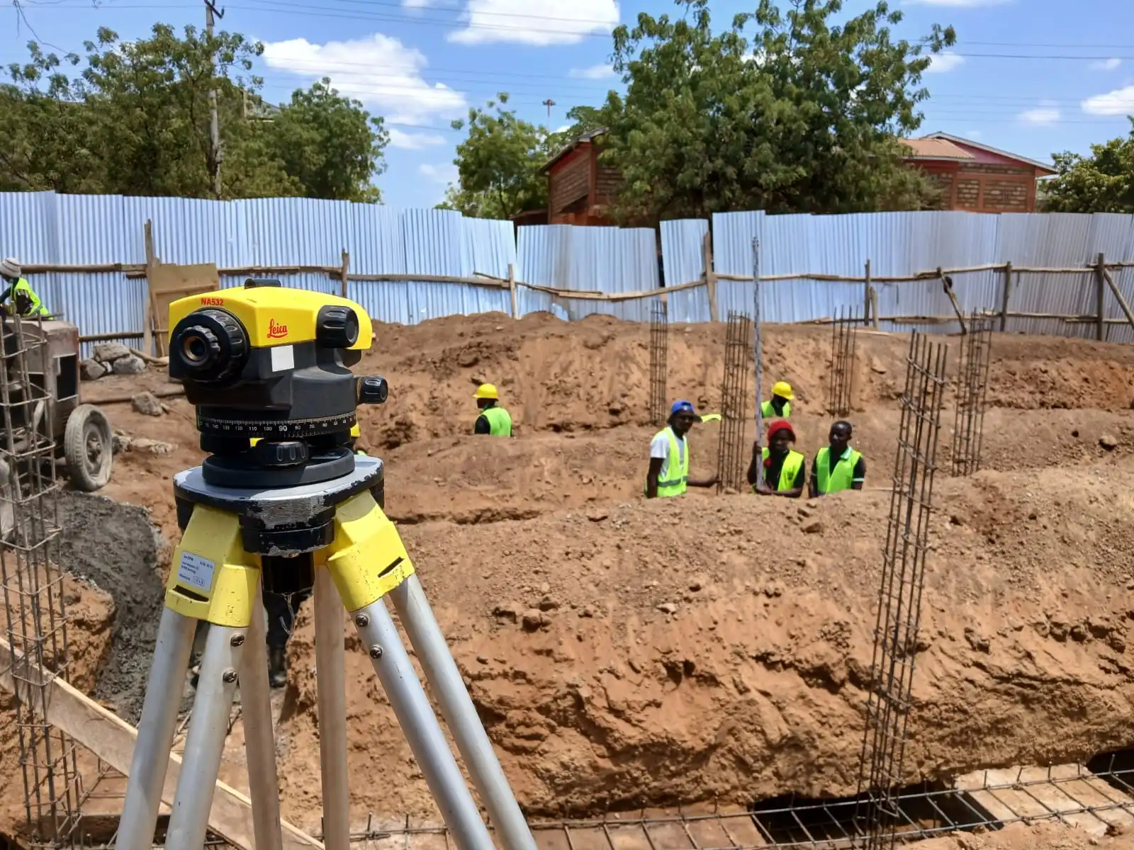
Engineering & Construction Surveys
Critical surveys for construction projects ensuring accurate positioning, alignment, and compliance with design specifications.
Who Needs This Service?
- ✓ Construction companies
- ✓ Civil engineers
- ✓ Road and infrastructure contractors
- ✓ Building developers
- ✓ Utility companies
Deliverables
- ✓ Construction setting out
- ✓ As-built surveys
- ✓ Volume calculations
- ✓ Structural alignment
- ✓ Progress monitoring reports
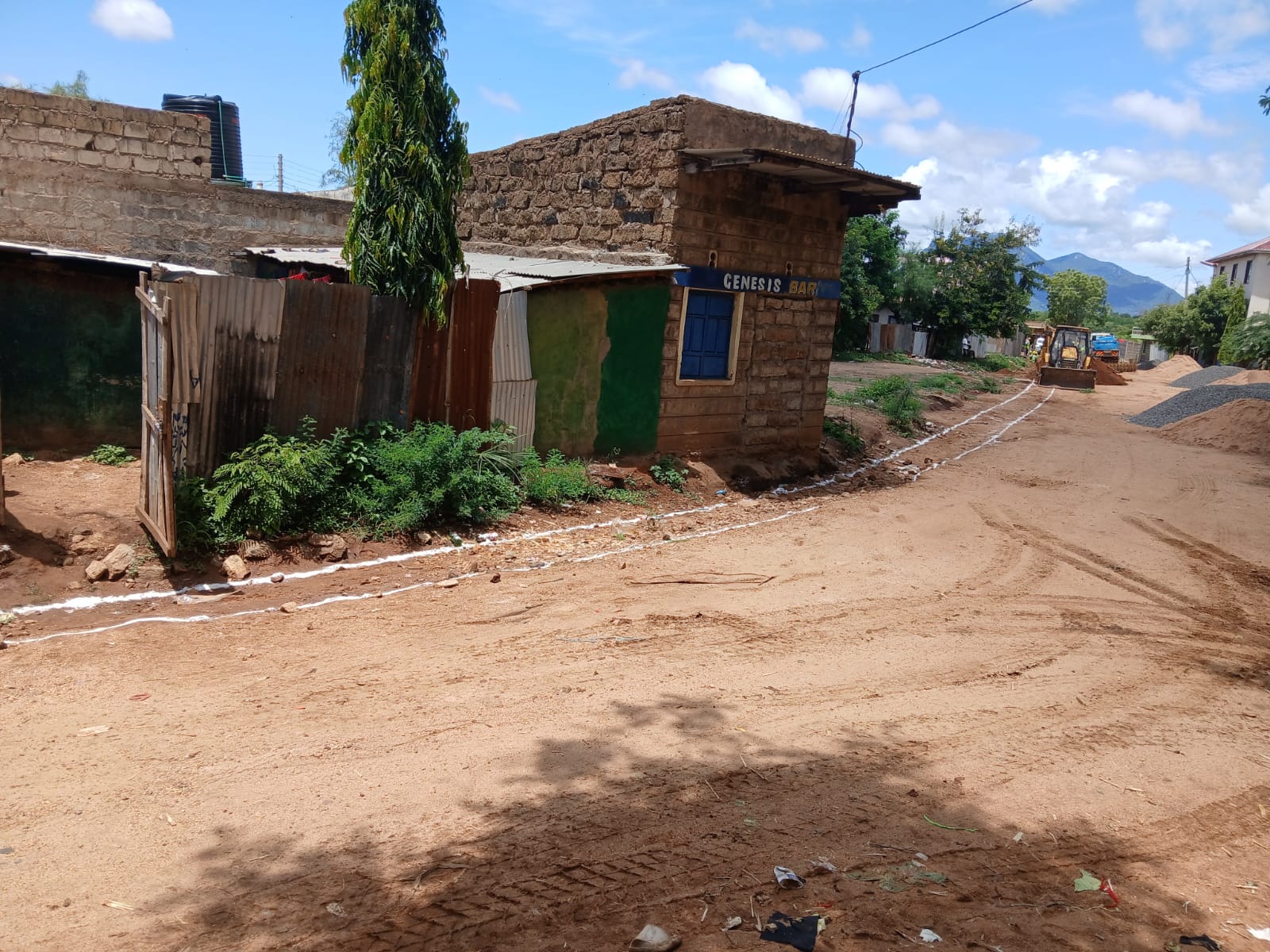
Subdivision & Mutation Surveys
Legal process of dividing land into smaller plots. We handle the complete mutation survey process and submission to the Ministry of Lands.
Who Needs This Service?
- ✓ Land developers
- ✓ Real estate investors
- ✓ Property owners subdividing land
- ✓ Estate planners
- ✓ Cooperative societies
Deliverables
- ✓ Mutation survey plan
- ✓ Mutation forms (RLA)
- ✓ Survey report
- ✓ New title processing support
- ✓ Ministry of Lands submission
GIS & Mapping Services
Advanced geographic information systems and digital mapping solutions for data visualization, analysis, and land management.
Who Needs This Service?
- ✓ County governments
- ✓ Urban planners
- ✓ Environmental agencies
- ✓ Real estate developers
- ✓ Research institutions
Deliverables
- ✓ Digital parcel maps
- ✓ Land use maps
- ✓ GIS databases
- ✓ Spatial analysis reports
- ✓ Interactive web maps
Remote Sensing Surveys
Drone and satellite imagery for large-scale land analysis, environmental monitoring, and rapid assessment surveys.
Who Needs This Service?
- ✓ Large land owners
- ✓ Environmental monitors
- ✓ Agricultural planners
- ✓ Mining companies
- ✓ Disaster management agencies
Deliverables
- ✓ High-resolution orthophotos
- ✓ NDVI vegetation analysis
- ✓ Thermal imagery
- ✓ 3D models from drone data
- ✓ Change detection analysis
Powerline & Pipeline Surveys
Specialized surveys for linear infrastructure projects including route alignment, easement mapping, and corridor assessment.
Who Needs This Service?
- ✓ Energy companies
- ✓ Pipeline operators
- ✓ Transmission line contractors
- ✓ Infrastructure developers
Deliverables
- ✓ Route alignment surveys
- ✓ Easement mapping
- ✓ Profile drawings
- ✓ Structure positioning
- ✓ Environmental corridor maps
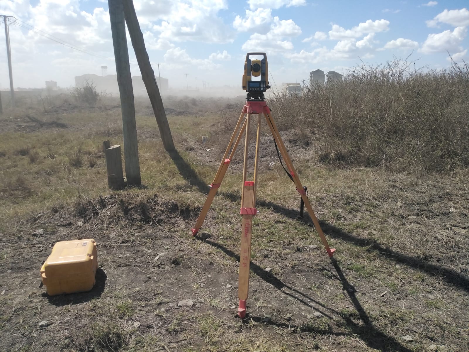
Modern Surveying Technology
Leveraging cutting-edge equipment for unparalleled precision
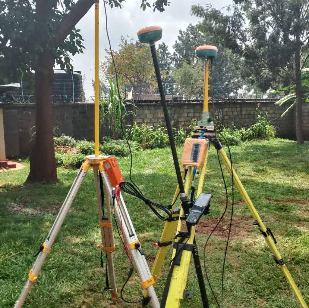
GPS/GNSS Systems
High-precision global positioning for accurate coordinate determination
Total Stations
Robotic total stations for precise angle and distance measurement
Drone Surveying
UAV technology for rapid aerial data collection and mapping
GIS Software
Advanced geographic information systems for data analysis
What Makes Eden Surveys Different?
100% Legal Compliance
All surveys meet Land Surveyors Board and Ministry of Lands requirements
Fast Turnaround
Efficient delivery without compromising on accuracy or quality
Transparent Pricing
No hidden costs - clear quotes with detailed breakdowns
Post-Survey Support
Ongoing assistance with land registration and follow-up queries
Need a Professional Survey?
Contact us today for a free consultation and accurate quote